
Keyword
Earth Science | Spectral/Engineering | Radar | Radar Reflectivity
3 record(s)
Type of resources
Topics
Keywords
Contact for the resource
Provided by
Formats
Update frequencies
Status
draft
-
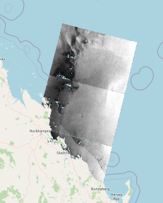
Sentinel-1 SAR medium resolution (approximately 20m-pixel size) reprojected and calibrated product produced by CSIRO under eReefs Phase 5 using the SNAP (Sentinel Application Platform) toolbox. This product was derived from Level 1 IW GRD (VV polarization), placed onto a regular grid using nearest neighbor resampling and radiometrically filtered using a three-pass combination of filters to reduce speckle.
-
This record describes data from the BASTA cloud radar, collected on the Marine National Facility RV Investigator voyage IN2015_V01. This voyage departed Hobart on the 21st March and returned to Hobart on the 29th of March, 2015. The BASTA cloud radar is a vertically-pointing 95 GHz FM-CW (Frequency Modulation - Continuous Wave) radar. It measures vertical profiles of radar reflectivity (approximately proportional to the cloud particle diameter to the 4th power), and Doppler velocity (sum of vertical wind speed and terminal fall velocity of cloud particles when pointing vertically) at 1.5s temporal resolution, and four different vertical resolutions (12.5, 25, 100 and 200m) up to 12 km height. Currently the instrument is not mounted on a stabilized platform but will be in a near future. This cloud radar is owned by the Australian Bureau of Meteorology. It was developed by the Laboratoire ATmosphere, Milieux et Observations Spatiales (LATMOS) in France. It is serial number 2. Calibration of the cloud radar was performed in 2014 using fixed targets of known reflectivity, and reflectivity in light rain.
-
This record describes the End of Voyage (EOV) archive from the Marine National Facility (MNF) RV Investigator Transit voyage in2016_t02, titled "Natural iron fertilisation of oceans around Australia: linking terrestrial dust and bushfires to marine biogeochemistry." The voyage took place from Hobart (TAS) to Sydney (NSW) between August 25 and August 29, 2016. Data collected during the voyage includes: (1) Acoustic Systems and Navigation: Acoustic Doppler Current Profiler (ADCP; 75, 150 KHz ), Fisheries echosounder EK60, Multibeam Echosounder - EM710, EM122, Sub-bottom Profiler - SBP120, GPS Positioning system, Doppler Velocity Log. (2) Underway: Starboard and portside Radiometers, Pyranometers, Radon, Oxygen, CTD, XBTs (Expendable Bathythermographs), Weather Radar, Greenhouse gas analysers - Aerodyne and Picarro, air pressure, wind speed and direction, PAR (Photosynthetically Active Radiation), Ozone, Thermosalinographs, (3) Voyage Specific: CPC: Condensation Particle Counters; CCN: Cloud Condensation Nuclei Counter; Gravity Meter; MAAP: Multiangle Absorption Photometer; SMPS: Scanning Mobility Particle Sizers; ISAR: Infrared Sea Surface Temperature Autonomous Radiometer. The EOV, XBT and Bridge logs were supplied and archived in pdf. ELOG files were generated as .csv and archived. All voyage documentation is available electronically to MNF support via the local network "global_docs." Access to voyage documentation for non-CSIRO participants can be made via DataLibrariansOAMNF@csiro.au. The archive for the IN2016_T02 EOV data is curated by the CSIRO Oceans and Atmosphere (O&A) Information and Data Centre (IDC) in Hobart, with a permanent archive at the CSIRO Data Access Portal (DAP, https://data.csiro.au/dap/), providing access to participants and processors of the data collected in the MNF RV Investigator IN2016_T02 voyage.